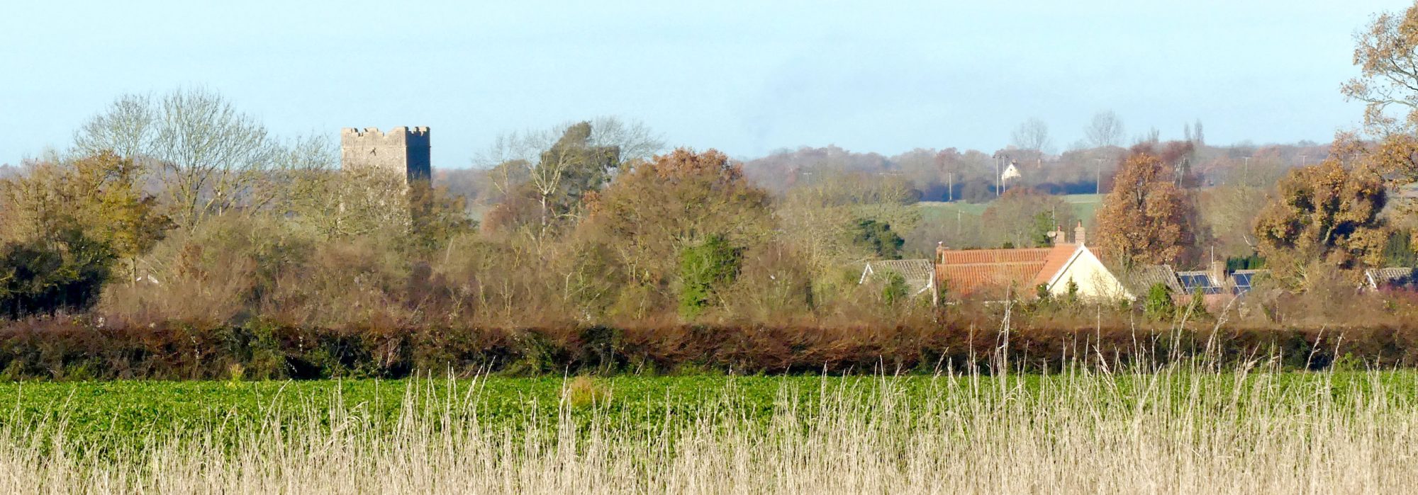
There was a windmill in Badwell Ash for over 140 years until circa 1930 when it was taken down. The mill was located to the west of Mill House in Hunston Road.
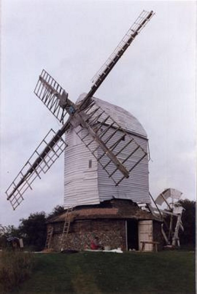
The first recorded windmill in England, which would probably have been a post mill, was built on glebe land owned by the Abbey at Bury St. Edmunds in 1189. Windmills became a very common sight in the countryside with almost every village having one or more by the C18. The oldest surviving windmill in Suffolk, and possibly in England, is the one at Drinkstone. Although it has the date 1689 carved into the timbers recent timber dating has revealed that the main post, the post that gives a “post mill” its name, was felled in 1568/9 with some of the other timbers in the mill dating from 1543.
Drinkstone Post Mill prior to its restoration 1973
©Mills Archive – Part of Peter Dolman Collection
It is impossible to find out how many mills existed in Suffolk during their heyday but on the first Ordnance Survey maps of 1836/8 no less than 430 are shown. However, with the introduction of steam powered flour mills, by 1926, when the first comprehensive survey of mills was carried out, there were less than 59 corn mills still working. By 1939, the number had dwindled to a mere 13 working examples. Today, although there are the remains of over 100 mills in Suffolk, only a very few are in a state of good preservation and even fewer are working. Mills that have been restored to working order include Bardwell, Pakenham, Saxtead Green, Stanton and Woodbridge.
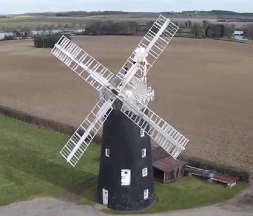
Bardwell, Pakenham and Woodbridge are tower mills where the body of the mill is stationary and only the very top of the mill, the “cap” carrying the sails, rotates to face the wind. A very good example of a tower mill is the one at Pakenham shown here.
Pakenham Tower Mill
©YouTube
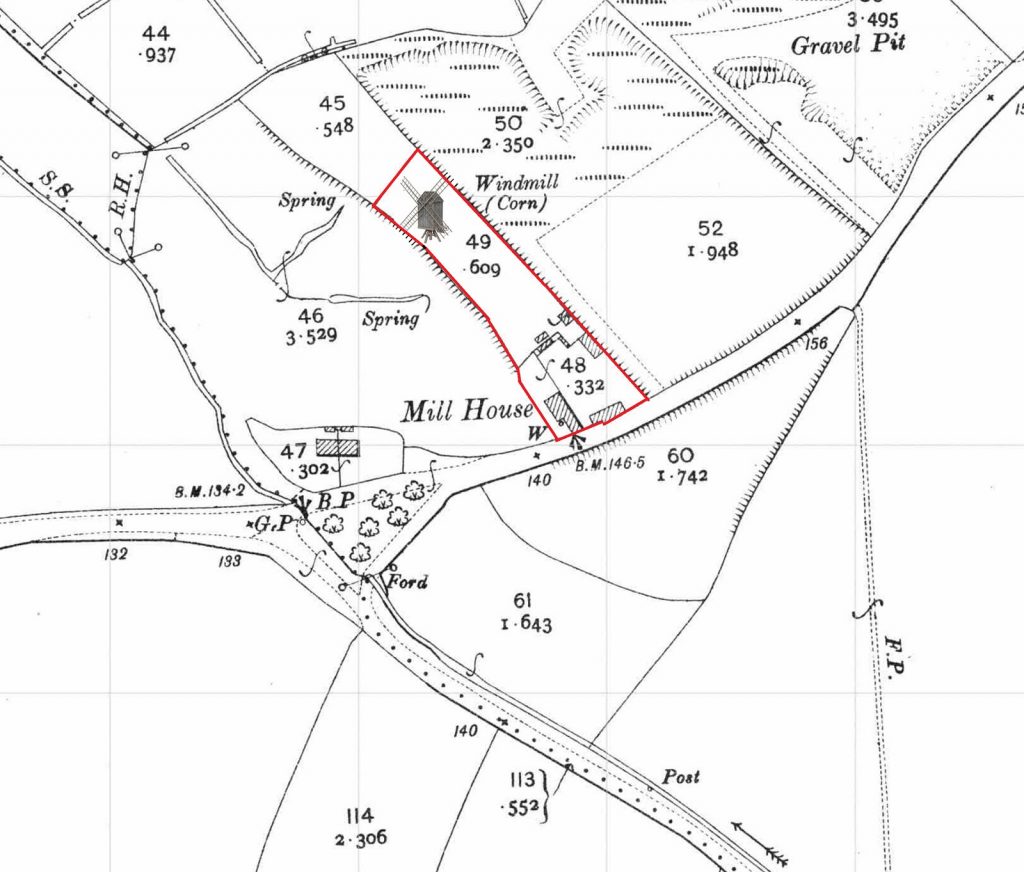
Badwell Ash Post Mill mill was taken down over 90 years ago. It was situated to the rear of The Mill House on Hunston Road as shown on this extract from a 1903 Ordnance Survey map.
©Ordnance Survey, County Series 1:2500 Dated: 1903
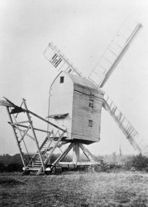
The mill was a post mill, the earliest form of windmill. The post mill derives its name from the massive oak post on which the body, or the “buck” of the mill was supported and around which it turned to keep the sales or “sweeps” facing the wind. The mill at Badwell Ash seems to have had “patent sails” which were like hinged shutters, a little like a venetian blind. In addition, the sails would adjust automatically according to the wind strength to maximise the use of the wind.
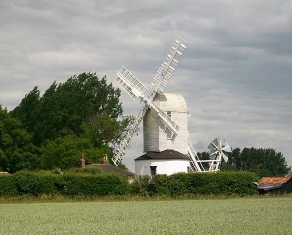
Perhaps the best known example of a Suffolk Post Mill is at Saxtead Green near Framlingham, owned by English Heritage and open to the public. This mill is very similar to the mill that was at Badwell Ash except the supporting structure, the “trestle”, sits on a “roundhouse” (the white painted round building shown below) whereas Badwell’s had an open “trestle”.
Saxtead Green Postmill
©English Heritage
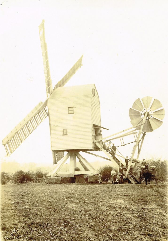
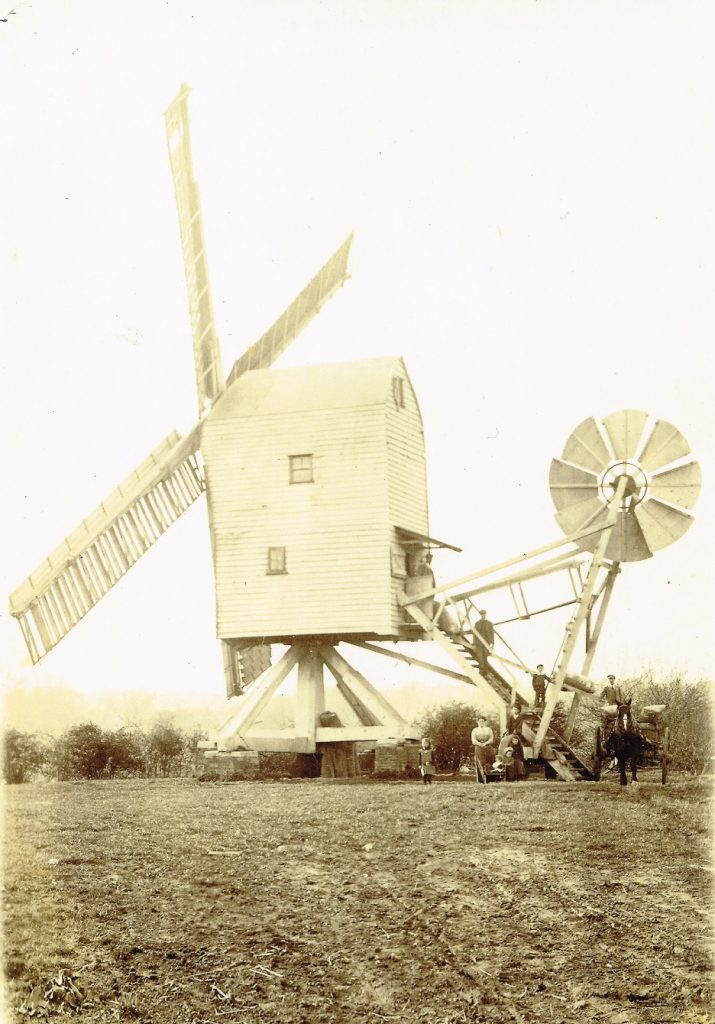
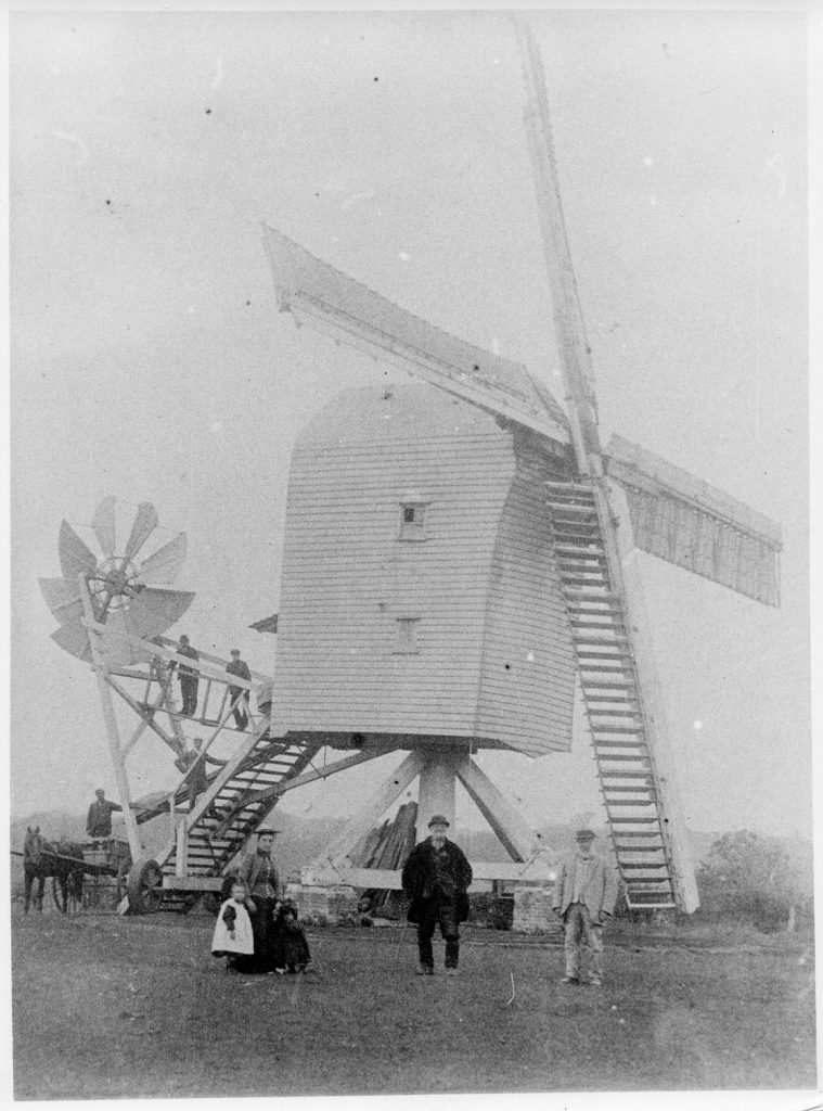
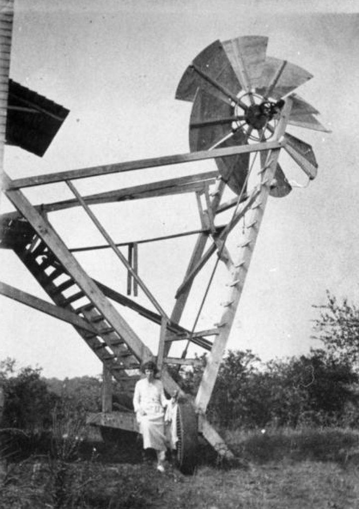
The mill at Badwell Ash also had a “fantail”, like the one at Saxtead. This is the small eight sided sail at the back of the mill at the bottom of the steps. As the wind blows, the sails of the fantail rotate and drive a shaft and cog wheel that engages with a track set into the ground which then turns the top part of the mill, the “buck”, to always face the wind. The fantail will stop rotating when the there’s no wind blowing on to the fantail and that happens whenever it is shielded by the buck (or the wind dies down). Therefore, the sails of the mill, which are attached to the buck, will always face the wind at 900, the optimum angle.
Badwell Ash Post Mill circa 1900
©Mills Archive
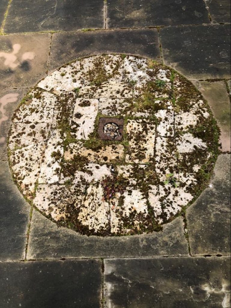
The four patent sails drove two pairs of stones. Each pair of stones consisted of a bed stone, which was fixed into place, and a runner stone driven by the sails. In most Suffolk and East Anglian mills the stones were usually made of French burr stone which was considered much better quality than the “home grown” grit millstones from Yorkshire. French burr became the most popular stone ever discovered for grinding wheat into white flour due to its superior quality. The stone is a freshwater quartz and was quarried at La Ferte sous Jouarre to the East of Paris. However, the stone is only ever found in small sizes so to create a millstone, several pieces have to be built up and bound together. One of the stones from Badwell’s mill has ended up in a patio in one of the houses in the village as shown here. Its construction from several smaller pieces of stone can clearly be seen in the photograph.
Millstone from Badwell Ash Mill
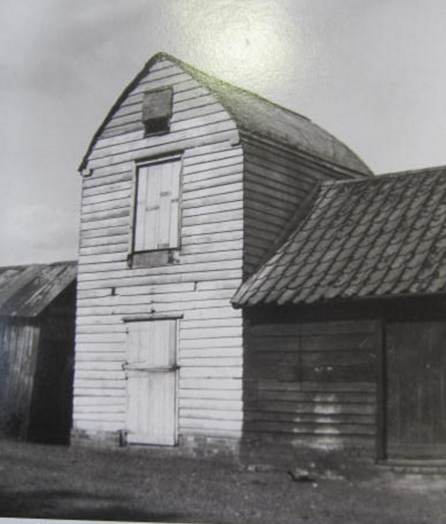
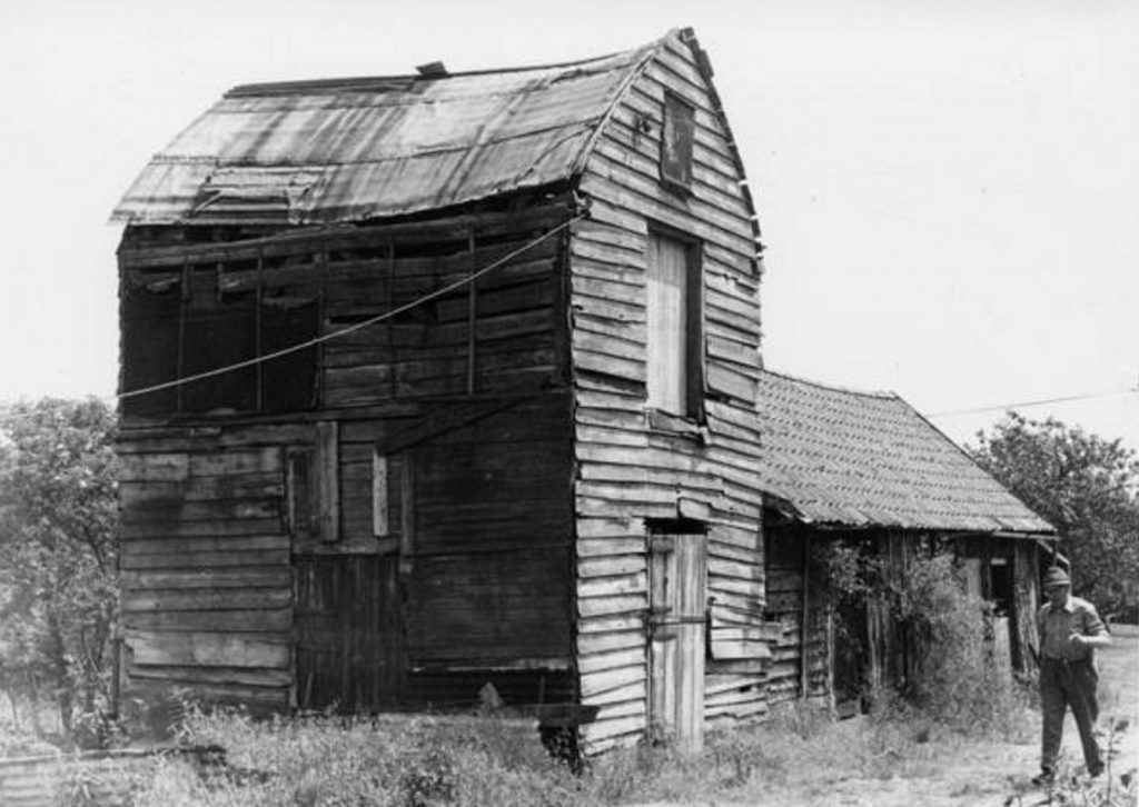
Badwell’s mill was taken down circa 1930 and the “buck”, the body of the mill, was used to build an outbuilding that accommodated an oil engine powered flour mill which had the appearance of a post mill but without the sails, as shown here.
Badwell Ash Mill circa 1933 showing the converted “buck”
©Mills Archive
It is known that this building was still standing in 1979 when Brian Flint, the author of “Suffolk Windmills” visited the site but sometime after, it was demolished. There is now no trace of it.
Badwell Ash Mill circa 1975 showing the converted “buck”
©Mills Archive
It is not known when Badwell Ash’s mill was built. As it has a marked similarity to a significant number of post mills in Suffolk that were built in the C17, it probably dates from early in that century. However, the mill did not originally stand in Badwell Ash. It was originally sited at “Mill Hill” in Hunston. On the west side of the road between Hunston and Hunston Green is a small mound which on early Ordnance Survey maps is described as a “camp”. It was originally thought that this was a “motte” from a very early “motte and bailey” castle. We now know that this was a mill mound on which the post mill once stood. It was not uncommon to put mills on small mounds to increase their exposure to the prevailing winds.
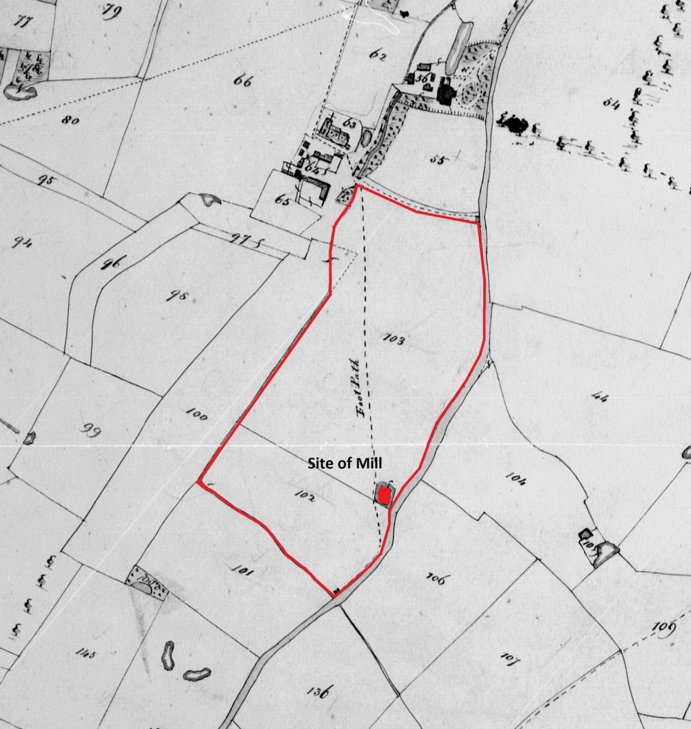
It’s understood that the mill at Badwell Ash was moved from this site in the parish of Hunston. It was originally located off the road between Hunston and Hunston Green. The location of the mill is shown superimposed on an extract from the Hunston Tithe map of 1845 below.
Hunston Tithe Map 1793
When the mill was at Hunston on the Rev’d Henry Heigham’s land, the Land Tax Assessment schedules of 1798 show a “Thomas Mudd” being a tenant of three parcels of land. Unfortunately, we cannot identify the land in question as there is no map accompanying the schedules.
On the 1845 Tithe Assessments for Hunston, two parcels of land, plots 102 and 103, that surround the former location of the mill are called “Mill Field” and “Mill Hill” respectively and are owned by John Henry Heigham, the Rev’d Henry Heigham’s son. By that date the mill had been removed to Badwell for almost 45 years. However, we know that a James Mudd, Thomas Mudd’s son was the miller at Badwell Ash. Therefore, it seems highly probable that prior to its removal to Badwell, Thomas Mudd shown as the Rev’d Henry Heigham’s tenant 50 years previously, was the miller.
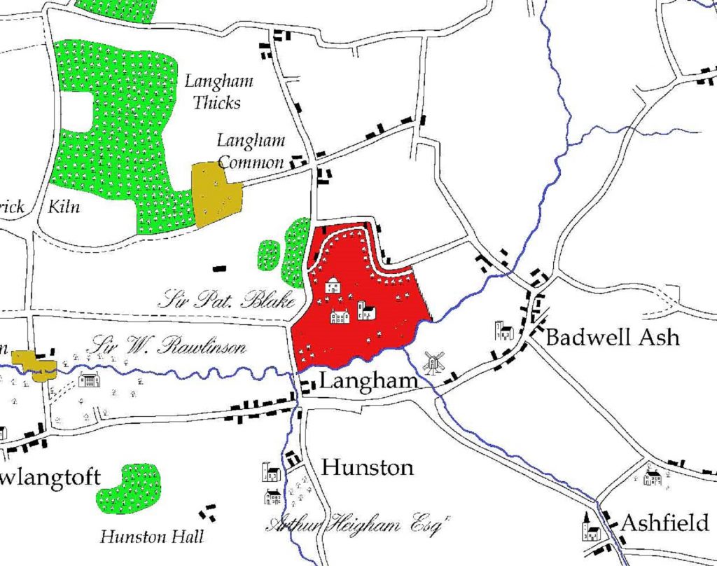
On “Hodskinsons Map” of 1783, the mill is shown as being in Badwell Ash (see below) so it seems probable that the mill was moved from Hunston in the last quarter of the C18.
Photo
Extract from Hodskinsons Map of Suffolk 1783 (digitally re-drawn)
©Andrew Macnair
It was not unusual for post mills to be removed to new locations. This usually happened when the existing site became no longer suitable due to encroaching buildings or trees which would prevent the wind from striking the sails. The Mill at Hunston was erected on a small mound which perhaps became unsuitable as hedgerow trees grew up around it. By the very nature of their construction, post mills could be removed relatively easily by ox and cart to a new location.
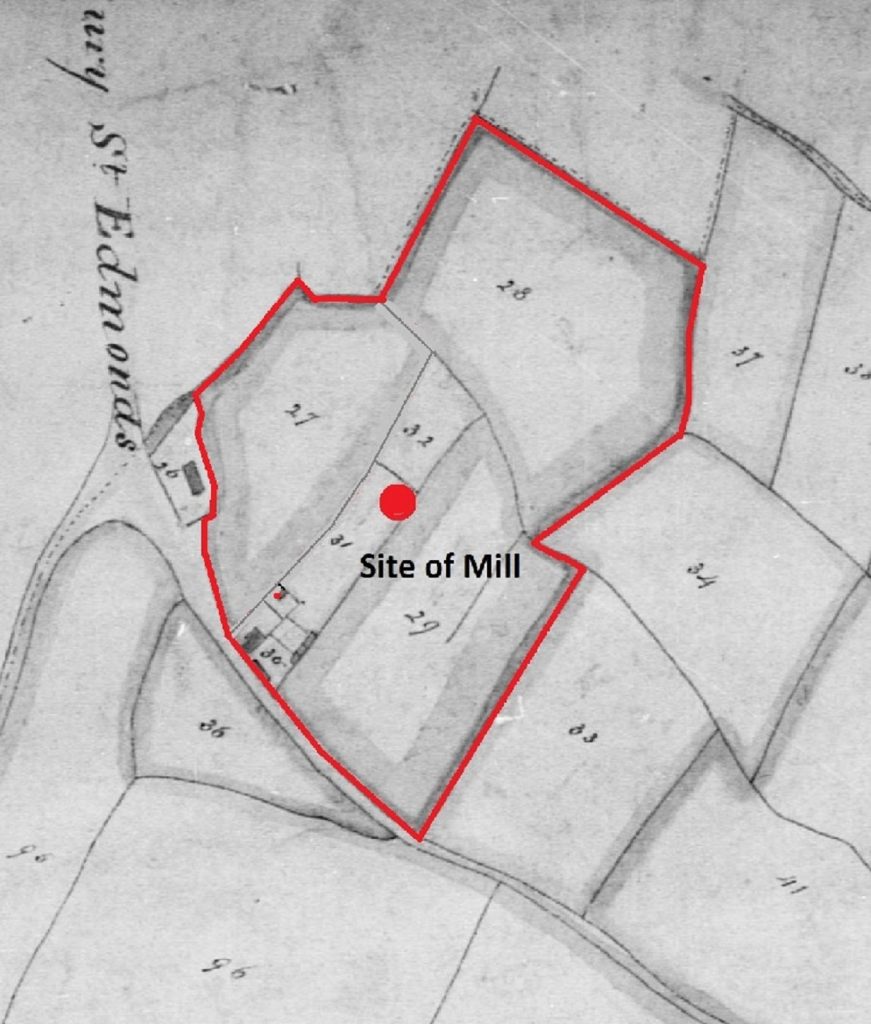
Badwell Ash Tithe Map 1838 – Plots 27-32
©Mills Archive
The site of the mill at Badwell Ash is shown on the Tithe Map of 1839 together with other lands occupied by James Mudd, who was the miller at the time. Two of the parcels of land, plots 27 and 28 were owned by Walsham and Thurston parishes respectively. Additionally, the land shown as parcel 29 was known as “The Town Pits” and would seem to have been a sand a gravel quarry, perhaps owned by Badwell Ash parish. Mr. Mudd made good use of the pit as he is found to be advertising stone and gravel for sale in the Trade Directories of the period.
Tithes, in existence since the C11, were originally a payment in “kind” of a proportion of the produce off the land, such as corn, hay or livestock and were given to the clergy. Over time, many tithes were converted to cash payments, as it was more convenient, but were charged at different rates in differing parts of the country. The 1836 Tithe Act formalised and standardised this procedure for the payment of cash instead of payment in kind over the whole country. Tithe Maps, together with schedules of landowners and occupiers, were created to give a standardised level of payment for the amount of land used, which was still paid to the church. It was usually the occupier of the land that paid the tithe.
In the case of Badwell Ash Mill, the land shown edged red on the Tithe Map was owned by several landowners but all were in the occupation of James Mudd, the miller. The land is divided into various numbered parcels. These numbers identified the various fields. Some of these fields within the parish of Badwell had interesting historical names such as “Houchin’s Pightle” or “Great Luckups Ash” and “Lower Whistley Oak”, all of which have now disappeared. The field parcels were referred to on the Tithe Schedule of 1839 and the accompanying map to identify the owners of those fields, the occupiers, and the area of the land in order to assess annual amount of “rentcharge” payable.
The following table is an extract from the Tithe Schedule for Badwell Ash showing the various parcels identified above. The areas are identified as acres, roods and perches and the rentcharge in pounds, shillings and pence. There were 4 roods to one acre and 40 perches to one rood.
| Badwell Ash Tithe Map 1838 – Plots 27 – 32 | ||||||||||
| Landowner | Occupier | Field No. | Description | Area | Rentcharge | |||||
| acres | roods | perch | £ | s | d | |||||
| Parish of Walsham | Mudd James | 27 | Walsham Town Land | 3 | 1 | 12 | 0 | 9 | 0 | |
| Parish of Thurston | Mudd James | 28 | Thurston Town Land | 5 | 2 | 2 | 0 | 6 | 8 | |
| Parish of Badwell Ash | Mudd James | 29 | “Town Pits” | 4 | 1 | 24 | ] | 1 | 13 | 4 |
| Heigham John Henry Esq. | Mudd James | 30 | House and Premises | 0 | 1 | 22 | ] | |||
| Heigham John Henry Esq. | Mudd James | 31 | Mill Yard | 0 | 2 | 19 | ] | |||
| Heigham John Henry Esq. | Mudd James | 32 | Mill Field – arable | 0 | 2 | 4 | ] | |||
| 14 | 3 | 3 | 1 | 28 | 12 | |||||
Notes:
Plot 28: This rentcharge was payable to the Rector of Langham.
Plots 30-32: John Henry Heigham was the “squire” of Hunston Hall, alas; the hall is no longer in existence.
So the miller of the post mill in Hunston Road, Badwell Ash in 1839 was James Mudd son of Thomas Mudd of Hunston. As can be seen from the schedule above the mill, mill yard and the mill field were owned by the same John Heigham of Hunston Hall who owned the land of the site of the mill when it was at Hunston. We know Thomas was the miller at Badwell because in September 1822, when Thomas was 82 years old, he advertised in The Bury and Norwich Post for “….a respectable active youth, as an apprentice to a miller, where he will be treated as one of the family.” We also know from an announcement in The Suffolk Chronicle of September 1813 that Thomas had decided to retire from his farming activities in Hunston as he advertised the sale of his dairy herd. So, perhaps after 1813, after he had given up the farm in Hunston he retained his milling activities at Badwell Ash until his death in 1825 aged 86.
James Mudd, Thomas Mudd’s son, became the miller on his father’s death which is confirmed by the Tithe of 1839 where he is described as “Miller”. From the schedule above you will see that he is the tenant of the “Town Pits” and in an advertisement from The Bury and Norwich Post of February 1832 we can see that he is advertising the sale of “Building Stone at 10d per load, Paving at 1s 4d per load, Road stone at 6d per load and small gravel for Garden walks at 4d per load. All orders strictly attended to.”
However, in the first national census return of 1841, which was compiled in June of that year, James is missing. He had died earlier in the year, in February 1841, aged only 47 years old. His place as the miller was taken by his wife, Maria Mudd. In the same census return, William her son aged 15, is described as a Miller’s Apprentice. Also living in Mill House were their 3 daughters, aged 9, 7 and 15 as well as two servants! Maria gave up the tenancy of the mill about 1842/3 and moved to Farlingaye Hall, Woodbridge as a housekeeper where she died on the 4th August 1868.
The next miller was Henry Green. He is first mentioned in White’s Trade Directory of 1844 as a “corn miller”. In the 1851 census Henry Green is described as the miller aged 40 with George Buckle, 29 as his apprentice. He is living with his wife Maria aged 42 and servant, Ellen Buckle. By the 1861 census, George is missing and there is just one servant Sarah Anne Percy aged 16. No children are mentioned. During his tenure of the mill, Henry was a member of the Badwell Ash Association. This was a group of the leading citizens of Badwell, Ashfield, Hunston, Langham, Stowlangtoft, Walsham and Wattisfield who had formed this association in 1783 for “The Prosecution of Felons, Incendiaries and other Offenders”. In West Suffolk there was no police force until 1844 when the West Suffolk Constabulary was formed. The Badwell Ash Association took on the role of “policing” the various members’ lands and estates in return for an annual fee. The newspapers of the time are full of felons being apprehended by the Association and then being referred to the Ixworth Petty Sessions for crimes such as poaching, horse stealing, trespass and rustling.
Henry Green was obviously considered to be a “gentleman” of some standing as in 1862 he was selected as a member of the jury at Ixworth Court to hear a case of fraud and dishonesty. He was also the “star witness” in a trial in March 1872 where a William Wallace was accused of stealing a sewing machine. Poor William was found guilty and committed to Norwich prison having been given 6 months hard labour!
Also in the 1861 census, the next miller after Henry Green, Clears Fordham, is shown as being an apprentice or a “journeyman miller”. Ten years later in the 1871 census Clears is described as a “Miller”.
However, Henry Green is still shown as a “Miller and Farmer of 27 acres, employing one farm labourer and one boy” at Badwell Mill. Henry died in April 1872 and for a brief period, his wife Maria Green, is shown as being a “Corn Miller” in White’s Trade Directory of 1874.
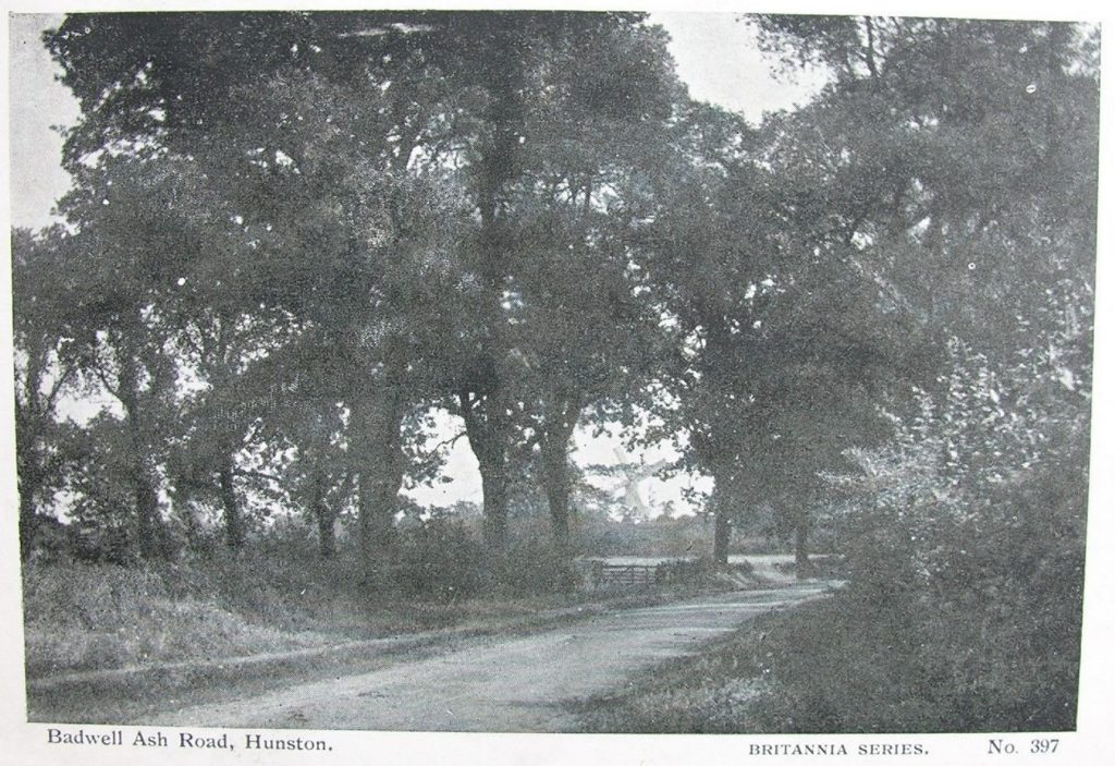
The Mill through the trees on Hunston Road circa 1880
Postcard
However, in the Kelly’s Trade Directory of 1879, Clears Fordham is described as a “Miller (wind)” and 10 years later in the next census of 1881 Clears, then aged 49, is described as living at Mill House and is a “Miller Master”. He is living at the Mill House with his second wife, Elizabeth (née Wilding) aged 35, his son Robert aged 21 also described as a miller, a daughter, Maria aged 11, and a son, Herbert aged 5. His sister-in-law Anne Wilding is also living with them and she is described as a “Carrier”. Clears’ first wife, Sarah (née Buckle) died in 1866. They had two children, Robert and Minnie.
In the 1891 census Clears, now 59, is shown as still living at the Mill House in Badwell Ash with Elizabeth, now 45, Rosina aged 22, Herbert Clears, aged 15 and Anne Wilding, aged 60 described as a “half-sister” and a Charwoman. Clears Fordham is also described as “Miller (wind)” in Kelly’s Trade Directory of 1892.
The Mill in 1900 with the Fordham family
©Mills Archive
In the 1901 census, Clears, now 69, is shown as being a Corn Miller, on his “own account” living with Elizabeth, now aged 56, Sidney Davidson, grandson aged 9, Herbert Clears Fordham (Head), aged 25 also described as a Corn Miller (worker), his wife Rachel (née Stevens) and their son Herbert Clears Fordham, aged 9 months. In the 1900 Kelly’s Trade Directory Clears is still described as the Miller (wind and steam) with his son Herbert Clears as an Assistant Overseer. It seems that sometime between the Kelly’s Directories of 1892 and 1900, to supplement the windmill, a steam engine was installed to drive the stones in times of slack wind and, no doubt, in an attempt to compete with the new roller mills springing up at the ports such as Ipswich and Felixtowe grinding imported wheat.
The Mill in 1900
©Mills Archive
Clears died in 1908 and therefore, in the 1911 census, Herbert Clears Fordham, his son now aged 35, becomes The Miller and is described in the census as a “Corn Miller and Merchant”. He is shown as living with his wife, Rachel, now aged 34, their son Clears, aged 10, George, aged 9, Leah a daughter, aged 8, Emily aged 7 another daughter, Egbert, aged 4, Harold, aged 2 Elizabeth, his father’s widow aged 66 and Sidney Davidson, aged 19, a nephew who is also described as an Assistant Miller. The Kelly’s Trade Directory of 1912 describes Herbert Clears as being the “Miller (wind and steam) and an Assistant Overseer”. In the 1916 Kelly’s, Herbert is described as the “Miller (wind and steam, Farmer and Assistant Overseer)”.
The Mill Fantail in 1927.
©Mills Archive
The next two entries in Kelly’s Trade Directories for both 1926 and 1929 still describe Herbert Clears Fordham as the Miller (wind and steam) and in the 1929 entry as “a stone and gravel pit proprietor “ as well. It appears that Clears was developing the “Town Pits” to the south-east of the mill to supplement his income.
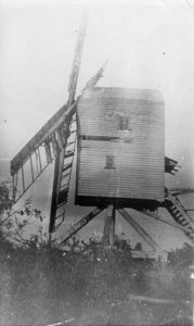
The two photographs below show the mill falling into disrepair by 1927. Although Herbert Fordham was described in the Trade Directories as a miller, “wind and steam”, it seems increasingly likely that all milling was carried out by steam power. It can clearly be seen from the photographs that the sails are in a poor state of repair, some of the weatherboarding is missing and the fantail has disappeared. In this state, it would not be possible for the mill to have been driven by wind.
The Mill, in 1927, decaying.
©Mills Archive
In the Kelly’s Trade Directory of 1937, Herbert C Fordham is still described as the “Miller (steam) and a Stone and Gravel Pit Proprietor and Haulage Contractor”. In the 1939 Register, a “census” taken just before the outbreak of WW2, Herbert Clears is still described as a “Corn Miller, Contractor Stone and Gravel”.
We can only assume that he was still milling using the mechanical engine located in the relocated buck as, by this time, the mill had been demolished. In the Register he is now aged 64 and is still living with his wife Rachel (63), Herbert Clears Fordham his son, a lorry driver (39), George Clears Fordham a lorry driver and farm worker (37), Egbert Fordham a stone and quarry worker (33), Lucy Fordham a shop assistant (26), Roy Fordham a boot repairer (20), Geoff Fordham a builder’s labourer (18), James Smith (25) and a Joan Slimm who was at school (11), all of whom were living in Mill House. Herbert Clears, the head of the household, is also described as a Special Constable.
According to Peter Dolman’s “Windmills in Suffolk “published in 1978 by The Suffolk Mills Group “….it (the mill) ceased work in 1924 and was demolished in 1930 due to its proximity to a sandpit. The materials were used to build a replica of the buck (the body of the mill) nearby which was used as a powermill and this still stands in derelict condition.
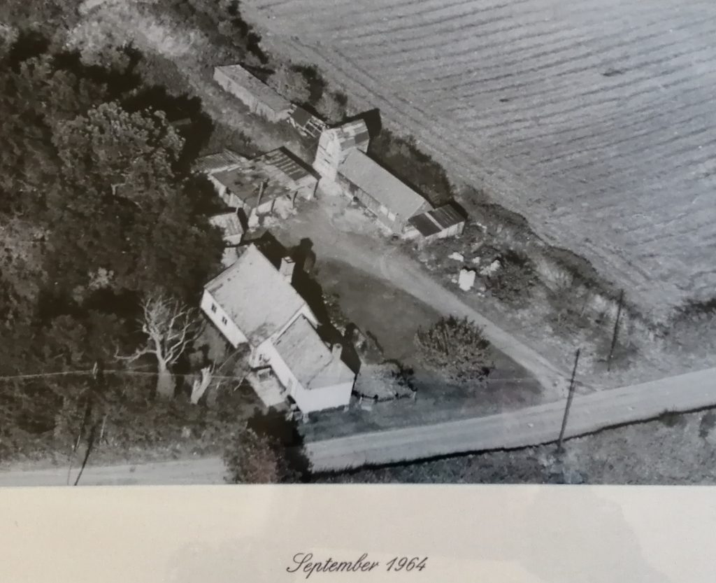
The relocated “buck” mentioned above was still in existence in 1964 as evidenced by the aerial photograph shown below.
We know that the old windmill buck still existed in 1979 when Brian Flint (author of “Suffolk Mills”) visited the site. However, sometime subsequently, during the last 40 years, it was demolished.
Badwell Ash Windmill – update 2023
In early 2021, the remains of the old mill buildings were demolished. The current owners received planning consent from Mid-Suffolk Council to demolish the remaining mill outhouses and replace them with an annex to the Mill House, accommodating residential accommodation. The design attempts to mimic the old post mill buck.
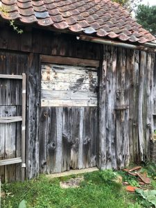
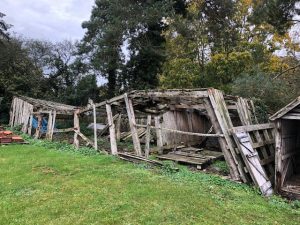
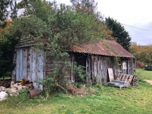
The outhouses comprised the following before they were demolished:
Mill Buildings before demolition
Proposed new building at Mill House
On the Heritage Gateway site, the mill is described as an:
Open trestle post mill, said to have been moved from Mill Hill, Hunston (HUN 002) in the C18, it ceased to work in 1924 and was demolished in 1930 due to its proximity to a sandpit. The materials were used to build a replica of the buck nearby which was used as a power mill, and this still stands in derelict condition. It had four spring sails, a fantail and drove two pairs of stones (S1). Shown on map of 1783 (S2)(S3). Shown on 1904 OS map – ‘Wind Mill (corn)’.
Suffolk HER Number (Pref. Ref.): BAA 011 Unique number (MonUID): MSF11541
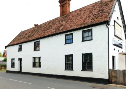
The Mill House itself is a Grade II Listed Building.
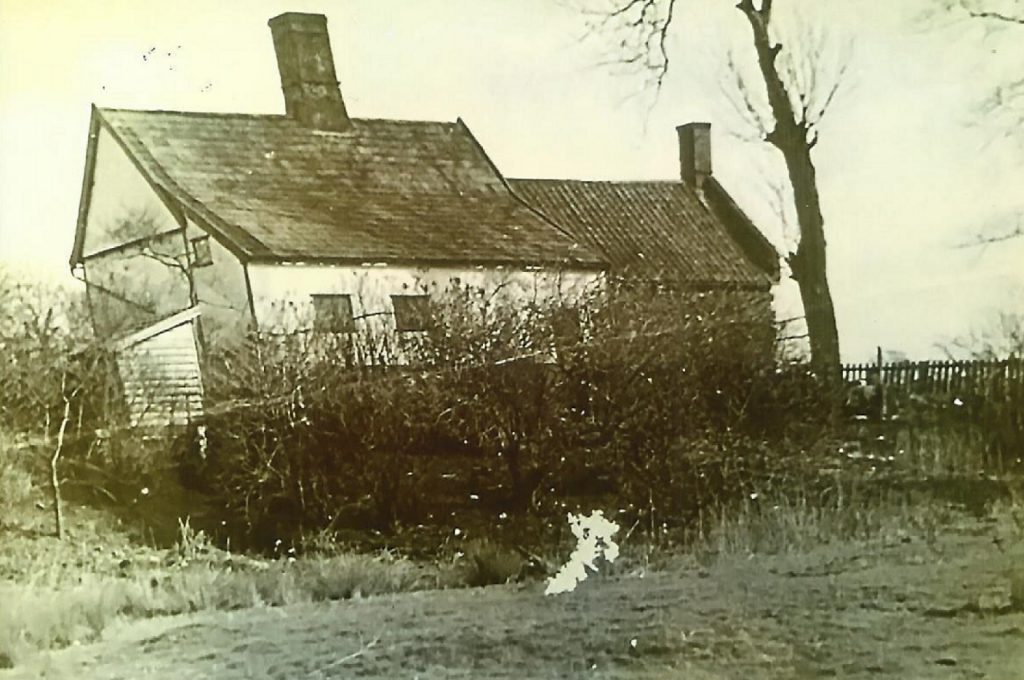
The Mill House circa late C18
Postcard
The Listing reads:
House, formerly associated with Badwell Ash post mill. Mid C17.
Timber- framed and rendered; double roman tiles. 2 storeys. 2-cell lobby entrance plan. A 1½-storey C19 extension at the south-east end has roughcast, clay pantiles, and a red brick gable-end facing the road with a chimney-stack and high coping;, a small dormer with a single-pitch slate roof and old 2-light casement windows, and 2 2-light casement windows to the ground floor with a half-glazed door between them. The main range has an internal chimney-stack with a plain shaft of Tudor bricks, 2 3-light small-paned standard windows to each floor and a C20 plank door. A 1½-storey lean-to along the rear, with the roof sloping up to the main roof. 4-bay frame, including a chimney bay, partly exposed inside: widely-spaced studs, arched braces, ceiling-joists set on edge. There is a good deal of older timber within the house, but no clear evidence of an older core. Roof not accessible.
The Listing indicates that there was a house on this site prior to the removal of the windmill from Hunston in the late C18 to the site of the mill to the west of the house.
Howard Newman
Badwell Ash History Society
November 2020
